Sewer Camera Inspection in Port Reading, NJ
A sewer camera inspection in Port Reading, NJ investigates railroad-town clay laterals — some a century old — against Arthur Kill tidal infiltration. The footage shows structural decay and visible water entry through failed joints, specifying the watertight renewal this waterfront setting demands.
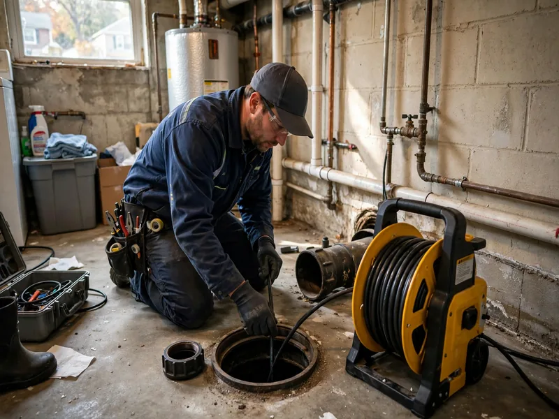
The survey applies the standard process to distinctive ground: a waterproof camera riding a push rod runs the lateral from house to municipal sewer, feeding live video while its sonde transmitter enables the technician to mark every finding's location and depth. In Port Reading, the technician watches for the twin signatures — structural deterioration in century-old clay and water entry driven by the tidal setting — and the footage documents both with the precision that repair planning requires.
The community's layers add variety. The 1970s Project Bowtie urban renewal rehabilitated hundreds of units and added new single-family homes, so renewed sections sit among original stock. Newer townhome infill runs on modern materials. Railroad and industrial parcels hold legacy deep lines. The camera treats each property on its own evidence — which, in a community this layered, is the only reliable approach.
For Port Reading homeowners, the inspection answers the waterfront question directly: is this line merely old, or is it old and taking on tidal water? The camera shows the difference, and the difference determines whether the fix is maintenance, sectional repair, or watertight replacement.
Century-Old Clay Beside the Arthur Kill
Port Reading's earliest homes — the 1910s-1920s worker housing of the railroad town — carry clay-tile laterals now approaching or past a century in service. The camera's tour of these lines shows the full age pattern: mortar long gone from joints, sections offset by a century of freeze-thaw, cracks admitting both roots and water, cast-iron interior runs scaled and channeled.
The tidal setting accelerates the deterioration story. Where inland clay fails primarily at its joints, waterfront clay fails at its joints and admits water through every opening — and moving water erodes. The camera often shows joints where infiltration has washed bedding soil from around the pipe, undermining the sections and accelerating offsets. It is a feedback loop the footage makes visible: water enters through failed joints, the entering water undermines the pipe, the undermined pipe offsets further, admitting more water.
Breaking that loop requires sealing the line — and the camera's documentation of every infiltration point is what specifies the watertight replacement. Seamless pipe, installed trenchlessly where feasible, ends both the structural decay and the water entry in a single project. The footage is the evidence that justifies that specification.
Tidal Infiltration: Reading Water on Camera
In Port Reading, the camera is as much a water instrument as a pipe instrument. Run in dry weather, it shows the defects that admit tidal and storm water: cracked joints, separated connections, porous breaks — each a potential inlet when the Arthur Kill surges or nor'easters drench the low ground. In some surveys, the camera shows active seepage: clear water visibly entering the line through joints, groundwater finding its path.
Homeowners experience this as the most confusing symptom pattern: backups and slow drains that arrive with storms and tides, then clear in dry weather. Snaking during a dry spell finds nothing conclusive; the next storm floods the basement anyway. The camera resolves the confusion by showing the entry points directly — the footage of water entering through a cracked joint is unambiguous.
The inspection timing matters. During or immediately after a surge event, the lateral may be flooded and the camera sees only water. The productive window is a dry stretch a few days after the event: water levels normalized, but infiltration points still showing seepage. Technicians familiar with tidal-zone work schedule accordingly.
The Community's Layers: Renewal Stock, Infill, and Legacy Lines
Port Reading is not uniformly old. The Project Bowtie renewal of the 1970s rehabilitated 225 units and added 34 new single-family homes — sections where laterals may have been renewed or replaced. Newer townhome and New Traditional infill runs on modern PVC. These properties need the camera's blockage-and-joint survey rather than the age assessment.
The railroad and industrial parcels are the wild cards: legacy deep lines from the coal-shipping era, large-diameter clay or concrete, configurations that reflect a century of site evolution. On these parcels, the camera is a mapping tool first — documenting material, path, connections, and condition before any work is planned — with the locator tracing routes through ground where undocumented utilities accumulate.
The McMyler Coal Dumper still stands as a relic of the railroad era; the sewer infrastructure of the same era is less visible but equally historic. The camera is how that hidden history gets read — and how its condition gets assessed without excavation.
When Port Reading Owners Should Call for the Camera
Storm-linked symptoms are the signature trigger: backups, slow drains, or basement water that arrives with heavy rain, nor'easters, or tidal surges and clears in dry weather. The camera, run in the dry window after, finds the infiltration points the storm exploited.
Recurring blockages independent of weather point to structural causes — roots, offsets, collapses — in the aging clay. The camera distinguishes these from infiltration-driven symptoms, which matters because the fixes differ: structural defects need repair or replacement, infiltration needs sealing.
Transaction diligence applies with waterfront emphasis. Buyers should inspect before closing — a century-old lateral in a tidal zone is a significant underground variable — and the camera's footage belongs in the decision. Sellers with sound, watertight lines hold a documented asset.
Post-storm assessment is the recurring need. After any surge or flood event that affected the property, a camera survey checks for new damage: displaced sections, debris carried in, joints opened by saturated-ground movement. Dated footage supports insurance documentation and distinguishes event damage from pre-existing deterioration.
Watertight Outcomes for a Tidal-Zone Community
When the camera's verdict is infiltration through deteriorated clay, the durable answer is watertight replacement: seamless pipe that admits no tidal water and releases no sewage. Trenchless installation — pipe bursting through the old line's path with minimal excavation — suits Port Reading's established streets and avoids open trenches in the low, wet ground.
When the camera shows isolated structural defects without significant infiltration, sectional repair addresses the bad segment at the locator's precise marks — surgical work that preserves the property above.
When the camera shows a sound line — the renewed Bowtie sections, the modern infill — the outcome is a documented baseline and a maintenance schedule: periodic cleaning, re-inspection every few years, and the recording on file.
For Port Reading, the camera inspection is ultimately a waterfront-readiness practice. The Arthur Kill is not going anywhere, nor are the storms. A lateral documented as watertight is a basement protected; a lateral documented as vulnerable is a project planned before the next surge plans it for you. The footage turns the tidal zone from a threat into a managed condition.
Local Insight
Port Reading's camera inspections confront railroad-town pipe in a tidal setting: a community built in the late 19th century by the Reading Railroad for Arthur Kill coal shipping, with 1910s-1960s worker housing — including a documented 1905 Crows Mill Road home — on clay-tile laterals now up to a century old. The camera documents the age pattern — failed joints, freeze-thaw offsets, root intrusion — compounded by the waterfront: at thirteen feet of elevation with over a fifth of the CDP in water, tidal surge and nor'easter rains drive infiltration through every cracked joint, and the footage shows water visibly entering the line. The 1970s Project Bowtie renewal and modern townhome infill add newer pipe to the survey mix, while railroad and industrial parcels hold legacy deep lines the camera maps before any work. Woodbridge River marshland adjacent and Arthur Kill tidal exposure make flood-zone verification on current FEMA maps prudent for specific properties. For Port Reading, the inspection is a waterfront audit — the survey that shows whether a century-old lateral is merely aged or actively admitting the tide, and the evidence base for the watertight replacement that ends both problems at once.
Reach Out Today
One call connects you with a local sewer professional serving Perth Amboy, NJ — day or night.
Reach Out Today: (833) 713-2101Frequently Asked Questions
My drains back up during coastal storms but work fine otherwise. What is happening?
Almost certainly tidal or stormwater infiltration: surge and heavy rain raise the water table, water enters your lateral through cracked clay joints, and the overwhelmed line backs up. In dry weather the entry points admit little water, so the drains seem fine. A camera inspection during a dry window shows the infiltration points directly — the cracked joints and separations the storms exploit — and the fix is sealing the line with watertight replacement, not clearing a blockage that is not there.
When is the right time to schedule a camera inspection here?
A dry stretch a few days after rain or surge: the lateral has drained to normal levels, but infiltration points may still show seepage on camera. Avoid scheduling during or immediately after a storm — a flooded lateral shows the camera only water. Technicians experienced with tidal-zone work plan around this window routinely.
Can the camera really show water leaking into the pipe?
Yes, clearly. Infiltration appears as streams or steady drips of clear water entering through joints, cracks, or separations — unmistakable on the monitor. Homeowners watching the live feed often find this the most convincing moment of the inspection: the invisible problem made visible, with each entry point located by footage marker.
Our street had 1970s renewal work. Does our lateral date from then?
Possibly, but verify with the camera rather than assuming. The Project Bowtie renewal rehabilitated many units, but lateral replacement was not universal — some renewed homes kept original lines. The camera identifies the pipe's material and approximate vintage in the first minutes, establishing whether your line is 1970s-era or older.
What is the risk of just living with storm-only backups?
Each infiltration event stresses the line further: entering water erodes bedding soil around the pipe, undermining sections and accelerating offsets — which admit more water next time. It is a deteriorating loop, and the camera shows its current stage. Beyond the pipe, repeated sewage backups are a sanitation issue for the home. Documenting the condition now lets you plan the fix rather than reacting to the storm that finally collapses the line.
Does a camera inspection help if we are planning waterfront-area construction?
Yes — the survey maps the lateral's exact path and depth, which construction planning needs to avoid damaging it, and documents its pre-work condition as a baseline. On parcels near legacy railroad or industrial ground, the camera also identifies undocumented lines before excavation begins. It is inexpensive diligence against expensive surprises.